Featured in

Global Opportunity Explorer2019 Insights
A celebration of on-going activities on the Global Opportunity Explorer
Geotab is working with cities’ transportation networks to collect and analyse data from air pollution to collision risk, helping to make cities smarter and safer.
Transportation is the blood of every city on the planet, running through the cardiovascular system of roads and railways. Geotab is collecting and analysing data from vehicles to monitor and improve cities’ health as they continue to grow.
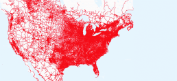
As wireless communication capabilities improve and their costs fall, it is becoming easier to collect data about a large range of city metrics. Geotab leverages data from over 1.3 million connected vehicles in a number of different cities to monitor and improve conditions including air pollution, traffic flows, collision frequencies, and emissions data.
In Columbus, Ohio, Geotab is working with the city to integrate its smart city insights data sets into their Smart Columbus Operating System (SCOS). By gathering, storing, analysing, and visualising real-time and historic data about the local transport network, Columbus will gain a more complete picture of local transport conditions. This traffic system intelligence will be essential in the effort to improve road safety as part of their smart city implementation plan.
In another example, Geotab installed air quality sensors on fleet vehicles in Houston, Texas, and revealed that just 10 or 20 fleet vehicles could map 50–70% of a city, indicating the potential for cities’ own fleet vehicles to be used as air quality monitoring devices without extra cost.
Why you should care
As cities grow in size and population, it is necessary to consider how transportation systems must be improved to maximise the health and safety of citizens. Geotab is leveraging the capabilities of big data and analytics to provide cities with the information to make targeted changes in areas like air quality, traffic conditions and road safety.
How the Global Goals are addressed
Good Health and Well-being
By using data to understand hazardous driving areas, Geotab’s approach can help cities to redesign traffic scenarios to reduce collisions.
Sustainable Cities and Communities
Geotab has a variety of methods for monitoring and analysing traffic conditions, helping cities to reduce their per capita environmental impact, particularly in air quality, and road safety.
Want to know more?
If you are interested in finding out more about this solution, please let us know and we can help you to find the answer.

Geotab
Geotab is a telematics solution provider, creating open-platform fleet management solutions to businesses of all sizes.
Global Goals addressed
Developed in: CanadaDeployed in: USAStage: Full implementation
Related
Nothing found.
Founding partners ofGlobal Opportunity Explorer

